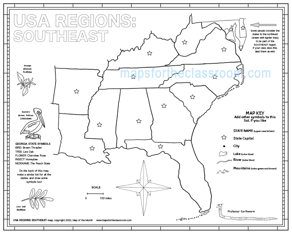
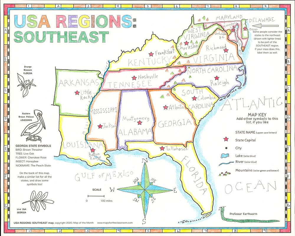
USA Regions – Southeast
$1.25
- Generously sized – 16 inches x 20 inches
- Outline map – perfect for shading & labeling with colored pencils
- Activities included – use with “on-map” activities or your own lesson plan
Buy Maps in Bulk, Save 20%
| Quantity | Per Item Price |
|---|---|
| 1-300 | $1.25 |
| 301+ | $1.00 |
Why You'll Love USA Regions: Southeast
Your students can learn about each particular region of the United States in great detail on this large, "zoomed in," easy-to-label map!
This map provides greater detail on a focused area of the US, especially useful for US history lessons.
Map Features
When you purchase this map you will receive links to download the free bonuses listed below. These are digital files that you can download and begin using immediately.

Bonus #1:
VIDEO: Completing the US Regions Southeast Activity Map
In this free video geography mini-course series, follow along with our resident cartographer Jason Newton as he completes this map step-by-step. Note: This bonus is not downloadable, but a video tutorial you can access directly inside our Earthworm University or from our YouTube channel.

Bonus #2:
CartoCraze - Appalachian Mountains
You will receive the Appalachian Mountains downloadable workshop (part of our CartoCraze membership.) In this workshop, students explore the mountain range in detail with loads of fun activities, learning resources, and extra printables.
From Blank to Beautiful
Why These Maps Work
You must be logged in to post a review.
You may also like…
What Educators are Saying


Reviews
There are no reviews yet.