Trails of American West Map
$1.25
- Generously sized – 16 inches x 20 inches
- Outline map – perfect for shading & labeling with colored pencils
- Activities included – use with “on-map” activities or your own lesson plan
Buy Maps in Bulk, Save 20%
| Quantity | Per Item Price |
|---|---|
| 1-300 | $1.25 |
| 301+ | $1.00 |
Why You'll Love the Trails of American West Map
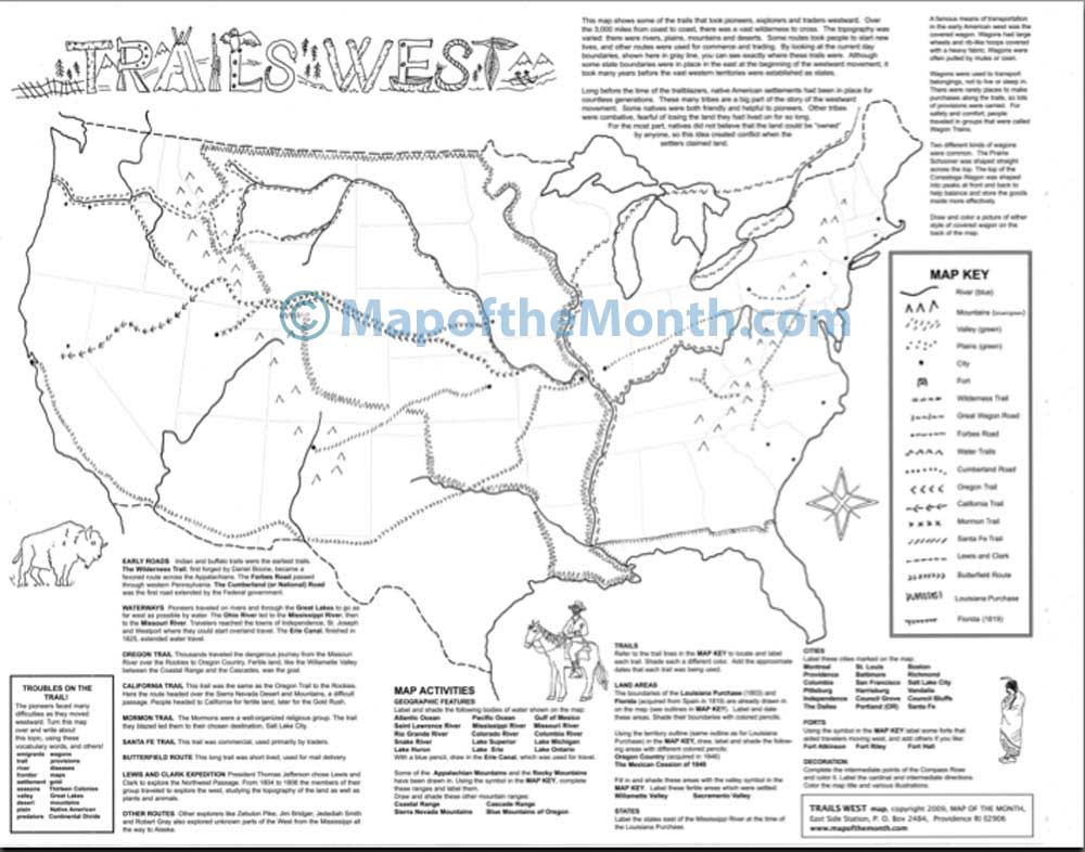
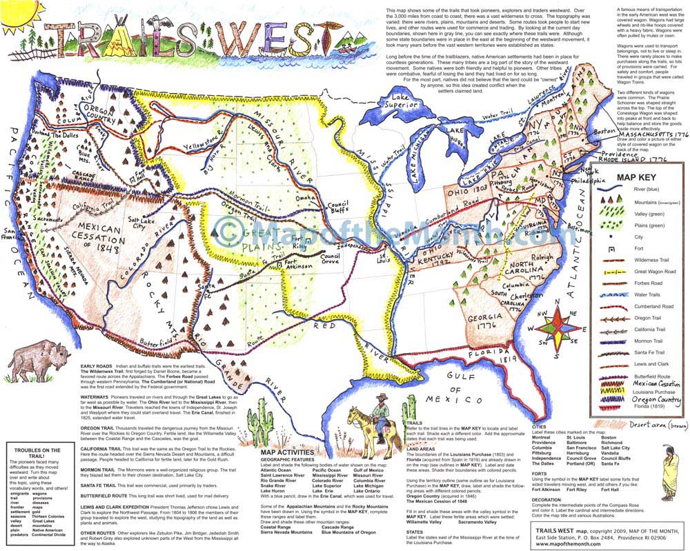
Your students will learn the roads and trails of the American Westward movement covered by pioneers and the difficulties they faced along the way.
Interesting details of early American transportation are included on the map.
Each map has loads of fun activities for students including locating, labeling and shading borders, major trails, routes, expeditions, mountains, bodies of water, cities, forts, and more!
Map Features
When you purchase this map you will receive links to download the free bonuses listed below. These are digital files that you can download and begin using immediately.

Bonus #1:
Step-by-Step Mapping - Trails of American West
Step-by-Step Mapping is a high-resolution digital file meant for projecting on a whiteboard or viewing on a computer. The activity map is shown in 4-6 stages of completion. A great way to add your own customizations when projecting on a whiteboard!

Bonus #2:
CartoCraze - Rocky Mountains
You will receive the Rocky Mountains downloadable workshop (part of our CartoCraze membership.) In this workshop, students explore the mountain range in detail with loads of fun activities, learning resources, and extra printables.
From Blank to Beautiful
Why These Maps Work
You must be logged in to post a review.
You may also like…
What Educators are Saying


Reviews
There are no reviews yet.