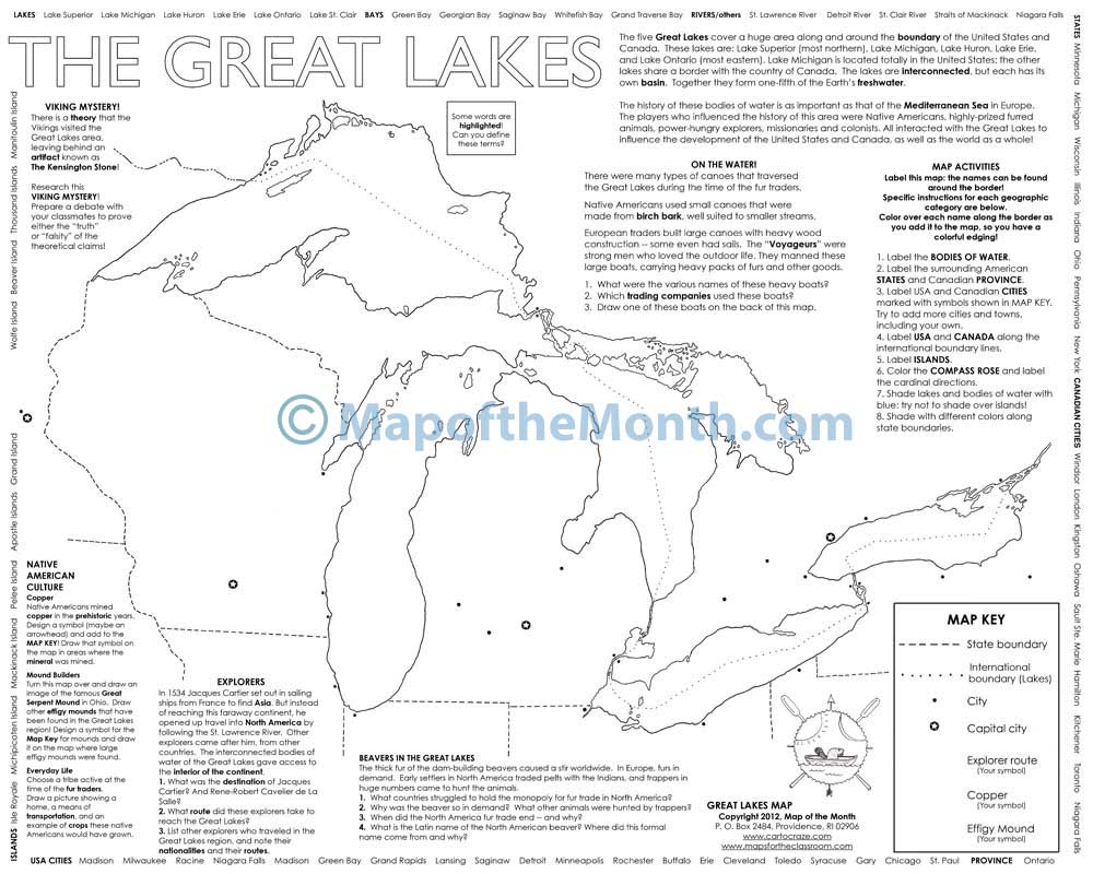

Great Lakes Map
$1.25
- Generously sized – 16 inches x 20 inches
- Outline map – perfect for shading & labeling with colored pencils
- Activities included – use with “on-map” activities or your own lesson plan
Buy Maps in Bulk, Save 20%
| Quantity | Per Item Price |
|---|---|
| 1-300 | $1.25 |
| 301+ | $1.00 |
Why You'll Love the Great Lakes Map
Your students will learn how these famous bodies of water changed the history of the world as we know it today.
Each map has loads of fun activities for students to gain a deep understanding of the region, including history, explorers, trade, and more!
Students will love getting to know the famous beavers and many types of canoes that traversed the Great Lakes.
Map Features
When you purchase this map you will receive links to download the free bonuses listed below. These are digital files that you can download and begin using immediately.

Bonus #1:
Step-by-Step Mapping - Great Lakes
Step-by-Step Mapping is a high-resolution digital file meant for projecting on a whiteboard or viewing on a computer. The activity map is shown in 4-6 stages of completion. A great way to add your own customizations when projecting on a whiteboard!

Bonus #2:
Finished Map: USA Regions - Midwest
You will receive the downloadable finished map of USA Regions - Midwest. Many of the teachers and educators who use our maps like to have a completed map that can be viewed on a smartboard or projected for enlarged classroom viewing.
From Blank to Beautiful
Why These Maps Work
You must be logged in to post a review.
What Educators are Saying


Reviews
There are no reviews yet.