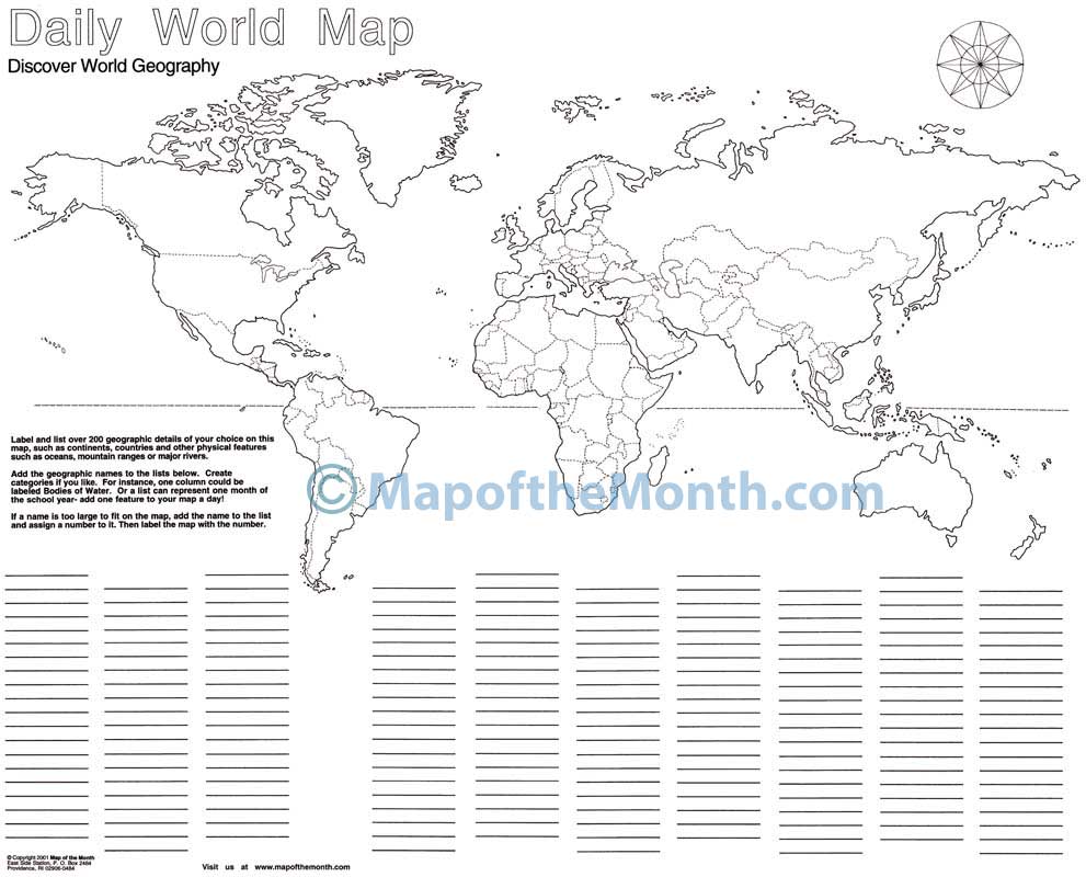
Daily World (Blank) Map
$1.25
- Generously sized – 16 inches x 20 inches
- Outline map – perfect for shading & labeling with colored pencils
- Activities included – use with “on-map” activities or your own lesson plan
Buy Maps in Bulk, Save 20%
| Quantity | Per Item Price |
|---|---|
| 1-300 | $1.25 |
| 301+ | $1.00 |
Why You'll Love the Daily World Map
Your students can learn world history and geography on this large map that is ideal for developing research and reference skills.
One of our most popular maps! Daily World has so many uses, including year-long independent projects and daily discussions.
Each map has loads of fun activities for students to gain a deep understanding of the world, including locating, labeling and shading borders, continents, countries, bodies of water, topography features, and more!
Map Features
When you purchase this map you will receive links to download the free bonuses listed below. These are digital files that you can download and begin using immediately.

Bonus #1:
Step-by-Step Mapping - Daily World
Step-by-Step Mapping is a high-resolution digital file meant for projecting on a whiteboard or viewing on a computer. The activity map is shown in 4-6 stages of completion. A great way to add your own customizations when projecting on a whiteboard!

Bonus #2:
CartoCraze - Nile River
You will receive the Nile River downloadable workshop (part of our CartoCraze membership.) In this workshop, students explore the river in detail with loads of fun activities, learning resources, and extra printables.
From Blank to Beautiful
Why These Maps Work
- Generously sized – 16 inches x 20 inches, ideal for students to see details.
- Outline map – perfect for shading & labeling with colored pencils.
- Printed on sturdy paper and shipped flat – no folds, creases or curly papers!
This blank DAILY WORLD map is one of our most popular maps! You will find a way to make this an essential item to support your teaching!
- All boundaries are completely shown.
- Countries, continents and bodies of water are unlabeled.
- Blank columns beneath the map allow students to label the map in a variety of ways, based on your curriculum needs.
- For instance, list categories: cities, bodies of water, countries within each continent!
USES ARE MANY!
- Provide your students with an ongoing independent project that lasts all year.
- Use for daily discussions while developing research and reference skills.
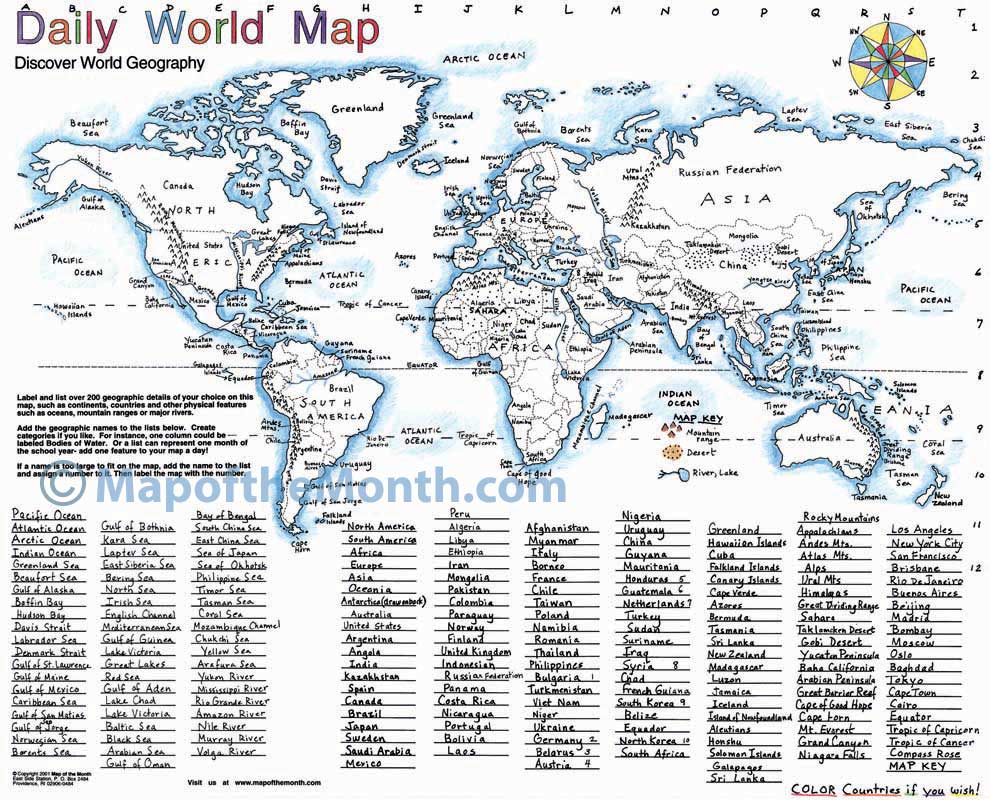
For a useful KEY, refer to our WORLD (Countries Labeled) map.
You must be logged in to post a review.
What Educators are Saying


Reviews
There are no reviews yet.