Civil War Map
$1.25
- Generously sized – 16 inches x 20 inches
- Outline map – perfect for shading & labeling with colored pencils
- Activities included – use with “on-map” activities or your own lesson plan
Buy Maps in Bulk, Save 20%
| Quantity | Per Item Price |
|---|---|
| 1-300 | $1.25 |
| 301+ | $1.00 |
Why You'll Love the Civil War Map
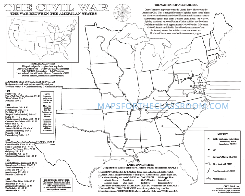
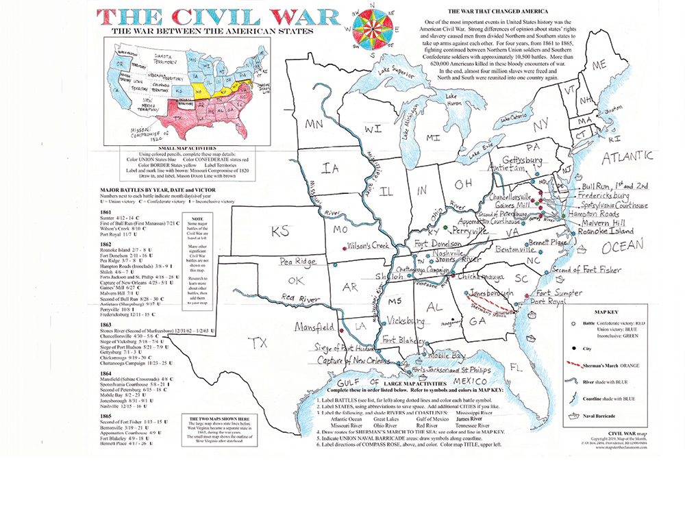
The Civil War map offers two maps in one, giving students a complete geographic picture of the Civil War.
On the large map, students label the 35 major battles and learn about geographic details that affected war.
On the small inset map, students label the union, confederate, and border states and key dividing lines.
Each map has loads of fun activities for students to gain a deep understanding of the Civil War, including locating, labeling and shading borders, bodies of water, cities, naval barricade areas, battle place holders, victors, western territories, and more!
Map Features
When you purchase this map you will receive links to download the free bonuses listed below. These are digital files that you can download and begin using immediately.
Bonus #1:
Finished Map: Civil War
You will receive the Civil War finished map. Many of the teachers and educators who use our maps like to have a completed map that can be viewed on a smartboard or projected for enlarged classroom viewing.

Bonus #2:
CartoCraze - Appalachian Mountains
You will receive the Appalachian Mountains downloadable workshop (part of our CartoCraze membership.) In this workshop, students explore the mountain range in detail with loads of fun activities, learning resources, and extra printables.
From Blank to Beautiful
Why These Maps Work
You must be logged in to post a review.
What Educators are Saying


Reviews
There are no reviews yet.