April 27
More fun with a SKETCH MAP of TEXAS
0 comments
Hands-on geography activity maps kids & teachers
Students love making sketch maps. These easy and colorful maps are are a hands-on way of reinforcing student skills in your classroom. Kids love a chance to practice research, design, and pen and pencil skills.
In today’s tech-focused atmosphere, don’t let your students forget how to hold a pencil!
What might be the best part of making a sketch map? While working on their maps, students will be having fun and learning at the same time! This post is all about making a sketch map of the state of TEXAS!
Present a sketch map project of the state of TEXAS to your students
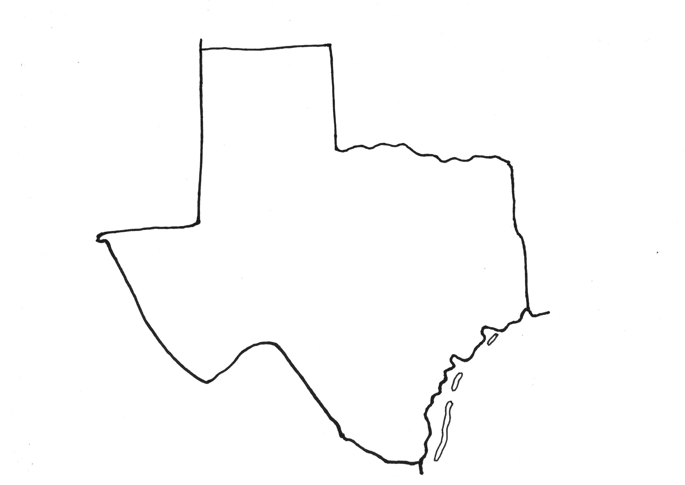
With a pencil and paper, make a simple outline of the state. Draw lightly to start, using an eraser if necessary. Make adjustments as you go!
Every student’s map will look a little different– and that is great! All students use their own skills to make an image of the state.
Click on any of the following images to see them larger size.
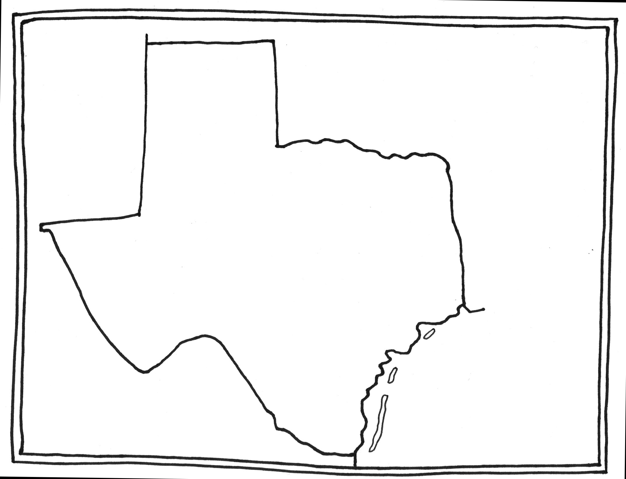
This next step is easy, but important.
Draw a border around the edge of the paper. This will frame your map!
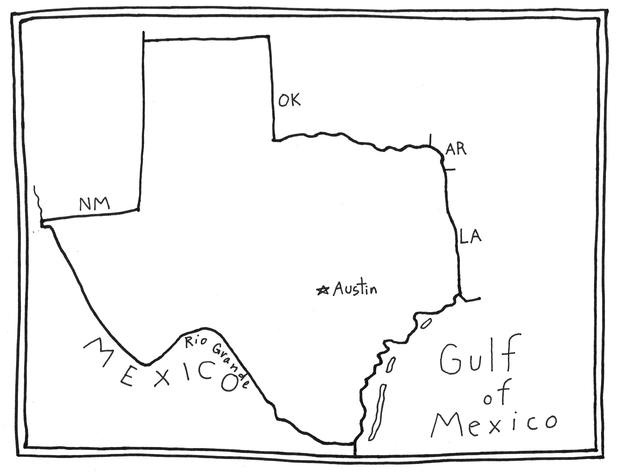
Here we will add a few easy geographic points!
Using a star, mark the state capital, AUSTIN.
Label the large body of water that is adjacent to Texas.
We have added bordering state abbreviations.
We also labeled the Rio Grande that forms a boundary with the country of MEXICO, which is also labeled.
With a little research, you can continue to add other details of your choice as well!
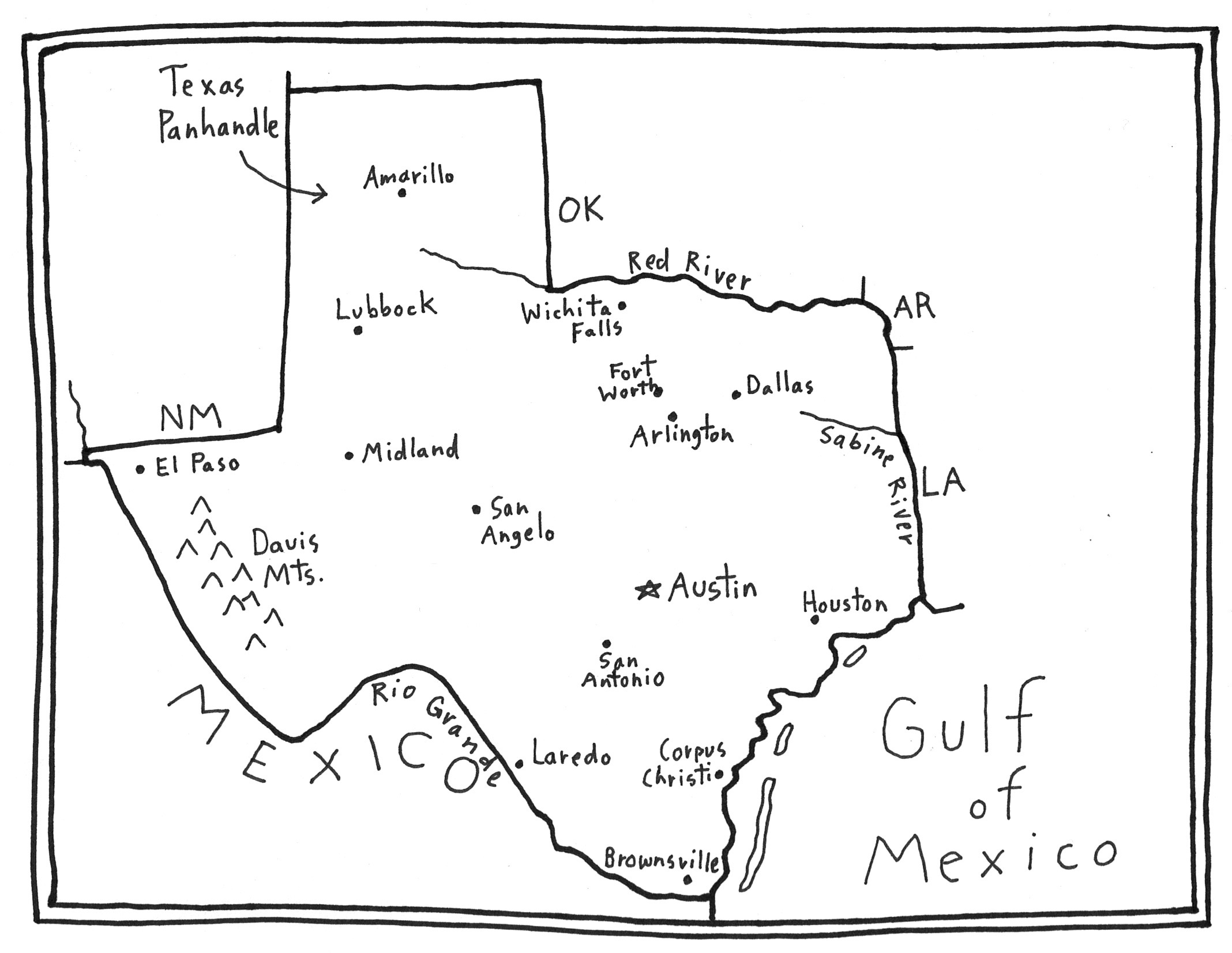
We chose to add a lot of Texas cities. You can add them as we did, or add other details of your own choice.
And we added the name “Texas Panhandle” that is used to describe northern section of Texas.
Here’s the best part: finishing your map with color and decoration!
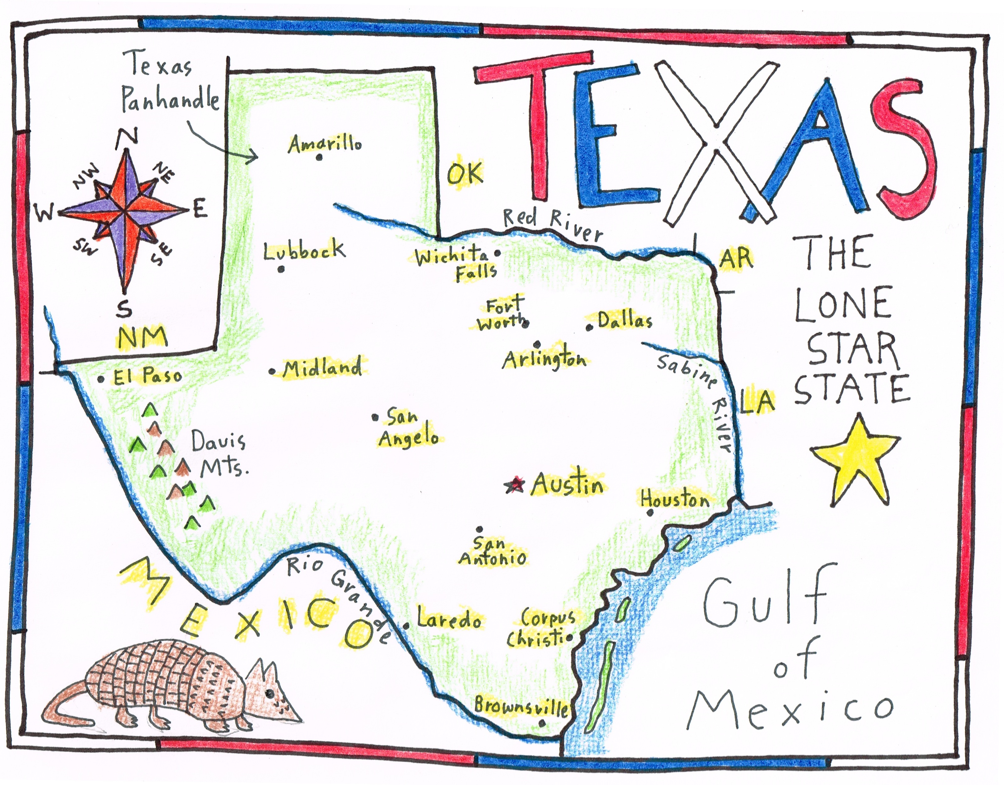
This step includes adding a title, a compass rose, and any other decorative details of your choice. It is fun to draw an armadillo, an animal found in Texas!
Feel free to start these details with pencil first, adjusting with erasure, before you finish with a bolder pen or marker.
Colored pencils, markers or crayons can be used to add color (we prefer colored pencils!).
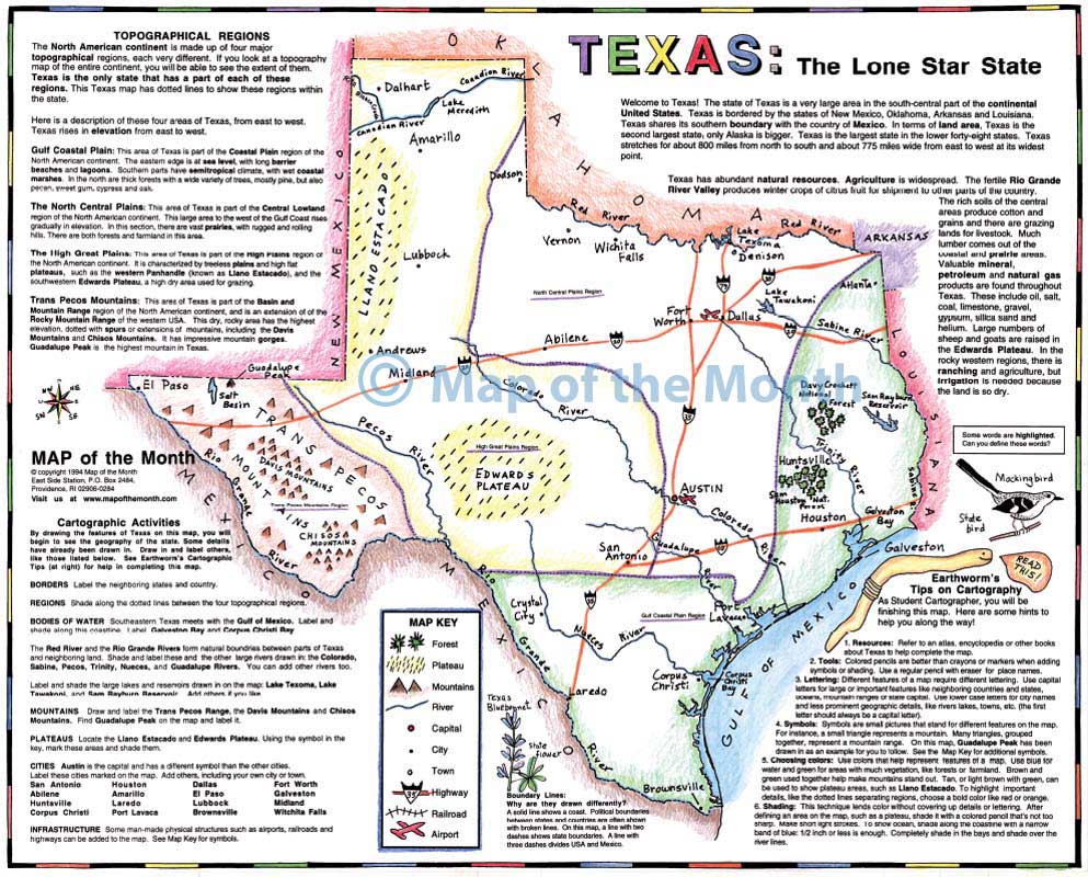
When you study TEXAS using our large 16 inch by 20 inch map, you will find this sketch map project to be a great additional activity that supports learning.
Why not have students draw their sketch map on the back of this map, as part of your State studies! Or draw it on the back of your USA map!
Tags
Session expired
Please log in again. The login page will open in a new tab. After logging in you can close it and return to this page.