February 11
Learning Continent Basics
0 comments
Hands-on geography activity maps kids & teachers
Students learn the basics of continents and oceans first. This prepares them to eventually move on to individual continents with advance preparation.
A blank map that shows all the bodies of land that make up the continents is very helpful.
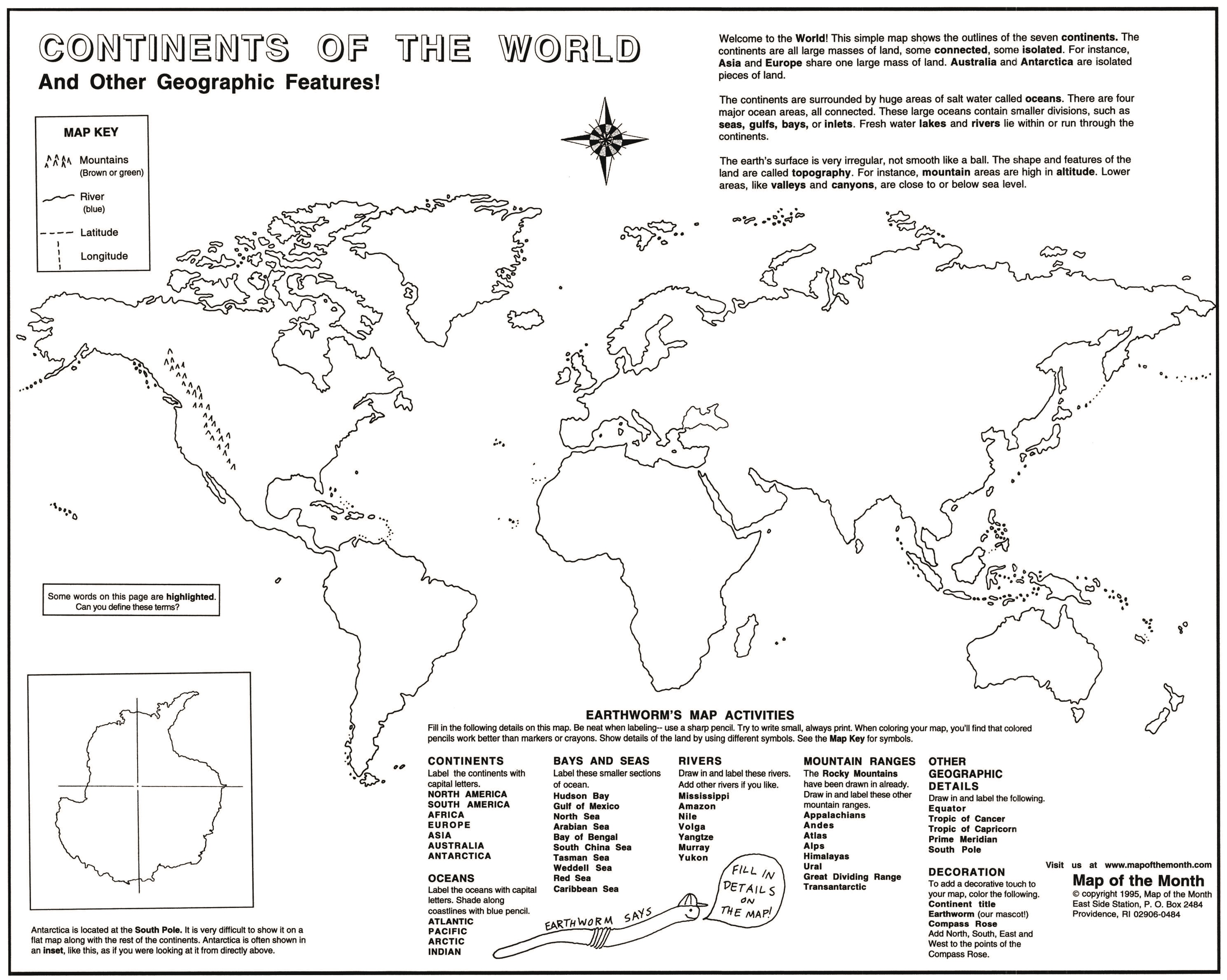
This large map– 16″ X 20″ — shows the outlines of all the continents, with Antarctica shown separately in an inset. Students label continents first. This is easy to do. At the same time they can see the location of the continents to each other. This map, found HERE, was designed with grades 1-6 in mind, but higher grades have found this map useful as well.
Next they move on to label the major bodies of water, which are the major oceans and seas. At the same time, students can shade in blue around the continents to show the coastlines of the areas of land.

Students can draw in a major river on each continent. Then they understand that a river a different kind of body of water than an ocean.
Drawing in the major mountain ranges, like the Rockies, on each continent is easy. Students begin to see that continents have topography that varies from one area to another.
For example, now it is easy to see that the Andes run along the wester side of the continent of South America. They can also see that the Amazon River is central and east in the northern part of the South American continent.
They can see the Mississippi River (see our FREE file about this famous river HERE!) runs from north to south in North America, with its mouth in the Gulf of Mexico.
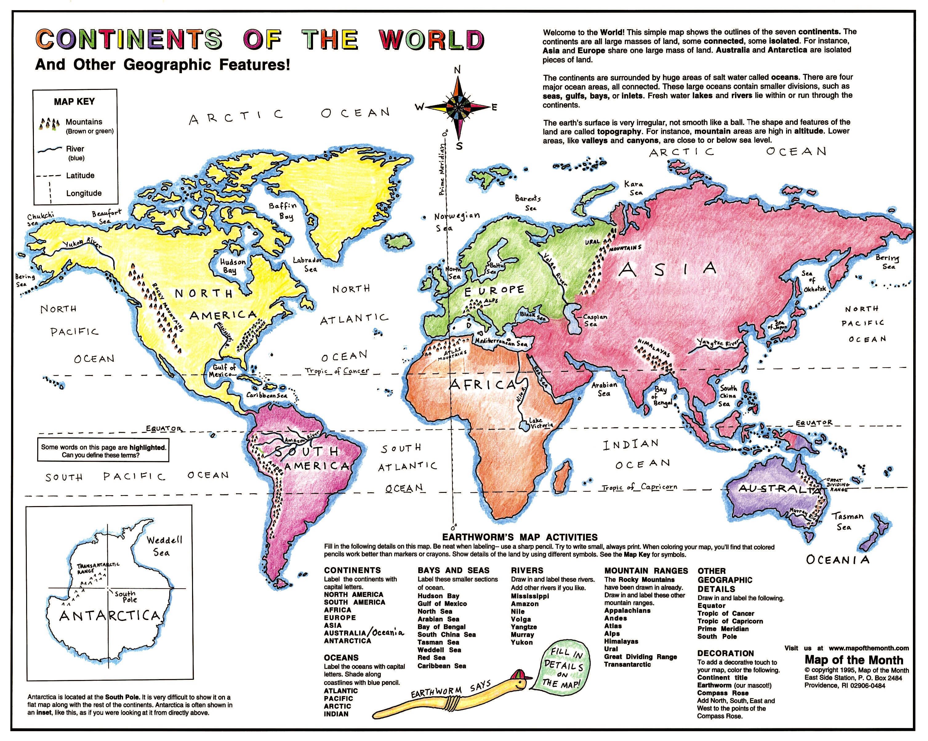
When introducing lines of latitude and longitude, why not start with the easiest ones to remember? Learning and drawing in some simple lines gives them a reference point for learning more about latitude and longitude lines later.
They can see that the PRIME MERIDIAN runs through the continents of Europe and Africa.
Drawing in the EQUATOR allows them to see the areas on earth that have the warmest temperatures. This is a useful introduction to the concept of CLIMATE.
By drawing in the lines for the TROPIC OF CANCER and the TROPIC OF CAPRICORN, students become aware of the term HEMISPHERE for the first time.
First, they get a strong overview of the major landforms and bodies of water that make up their planet EARTH.
Then they add in some details about topography — like mountains and rivers– plus geographic terms, like CLIMATE and HEMISPHERE.
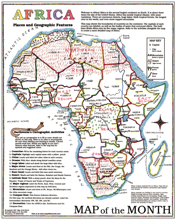
Here is an example of the completed map of AFRICA, studied as a single continent. With preparation, students already know where AFRICA is in terms of the oceans and other continents, as well as knowing that the ATLAS MOUNTAINS and the NILE RIVER are in the north!
Tags
Session expired
Please log in again. The login page will open in a new tab. After logging in you can close it and return to this page.