No products in the cart.
Hands-on geography activity maps kids & teachers
Teaching Tips
Get a little inspiration for completing your maps. We cover the basics and details that will really make your map stand out.
7 Tips to Help Your Maps Stand Out
When it comes to completing your map, there really is no wrong way. There are certain techniques and decisions along the way that can really make your map stand out.
How to Label Small Areas on a Map
A mapmaker’s goal to make the map clear and easy to read. There are many ways of labeling a smaller area on a map where there is not much room to write.
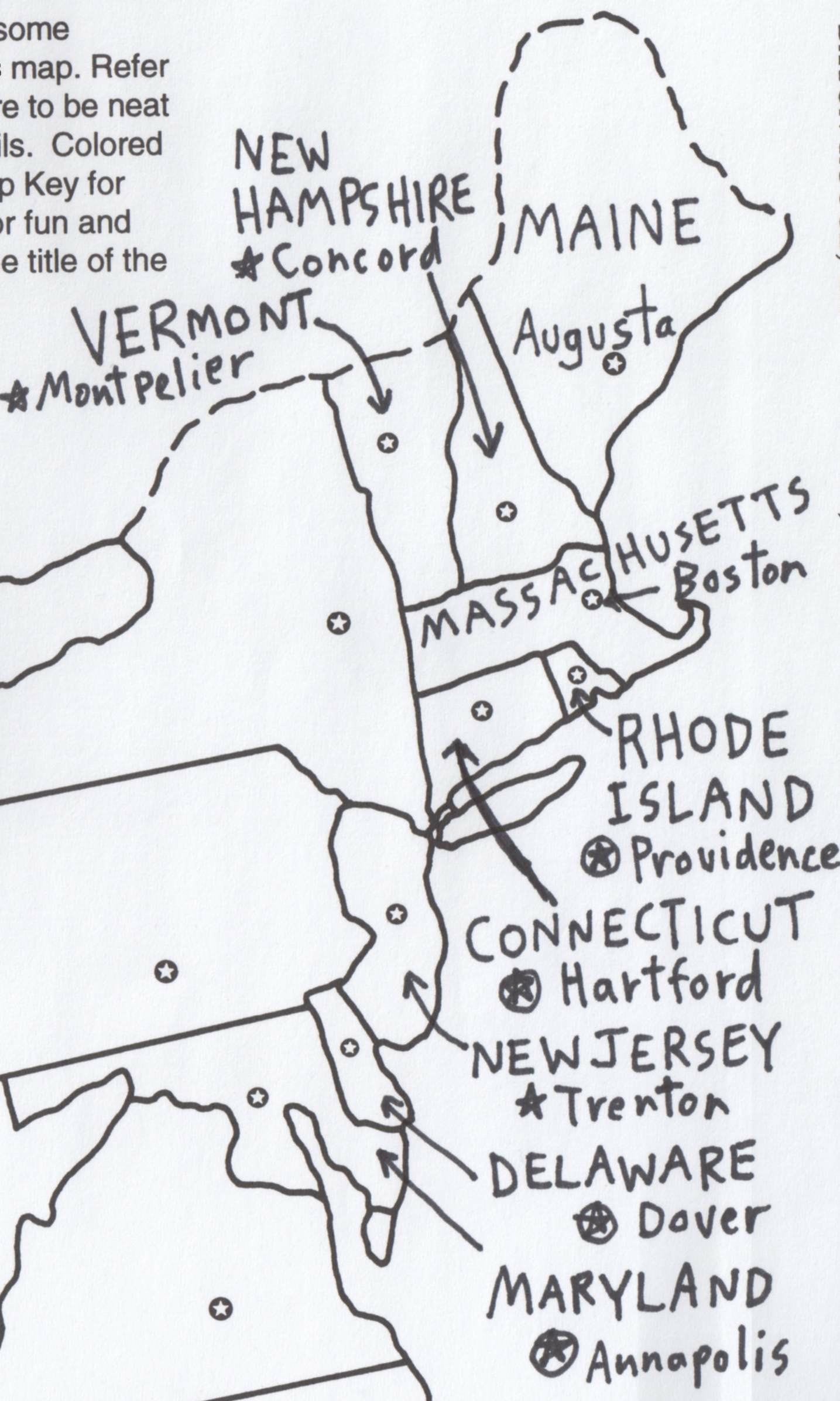
This lesson applies specifically to our USA PLACES AND GEOGRAPHIC FEATURES map. The area showing the states of the northeast is small compared to the states in the western part of the USA. It is easy to label the full name of a larger state because there is lots of room to write. With the small states, this is challenging!
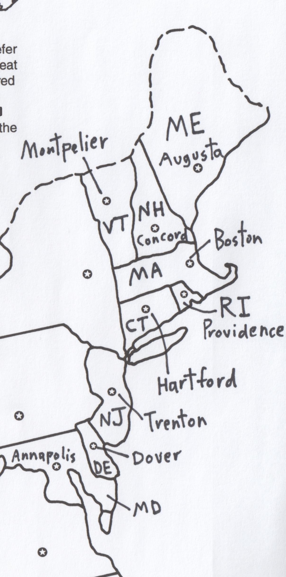
- 1Write out the whole name of each state
If you prefer to write out the whole name of each state, use the area to the right of the states. Label the name of each state next to it and use a leader line to connect the name to the state. - 2Use state abbreviations
Some mapmakers prefer to use the state abbreviation: it is your choice. This takes up less room and allows more room to draw in other details, like cities and other geographic features. That is why it is easier to label a map first before drawing in other details!
Color Choices
Coloring is a very important and fun aspect of working on your map. Colors should match the geographic details of a map when possible. Here are come suggestions:
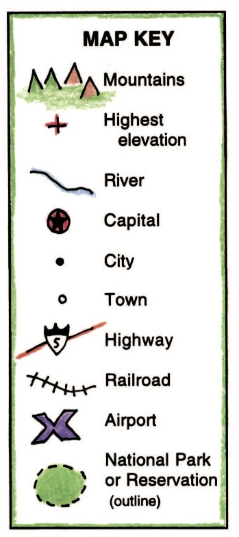
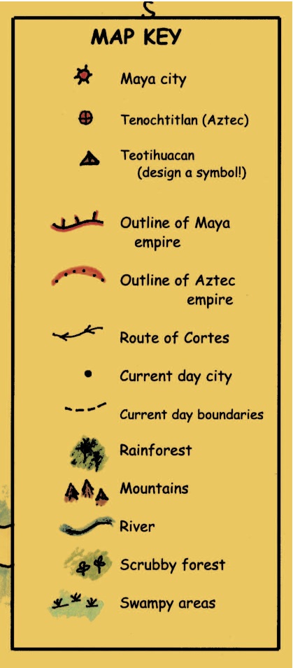
Symbols in a Map Key
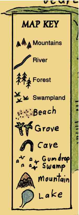
Symbols are small pictures that stand for different features on a map. A symbol is often drawn to look like what it represents. For example, a triangular shape is often used to denote a mountain. A desert is often shown by a group of dots that might look a little bit like sand. A forest could have little shapes that look like trees. A railroad can be shown as a line with bars drawn across it, like a train’s track.
All the symbols for a map are often grouped together in a MAP KEY for reference. Sometimes the MAP KEY is a box shape where the symbols are arranged. Sometimes the symbols are just displayed in a more freeform manner, without a box around them.
When you are coloring symbols, it is good to match colors to what you are depicting. For instance, mountains can be drawn brown and green. If a school is shown it could be red (like a brick building). Trees and wetlands are green, and so on.
Symbols should make some sense. If you are designing symbols for a map, think about shapes that remind you in some way of what you are showing. For instance, you might use an envelope shape, as in the key show here, to represent a Post Office building.
In atlases and professional maps, there are also Map Keys that indicate different kinds of lettering, the size of cities, population and other map details.
Here are some examples of Map Keys we use:

Coloring & Shading
When shading an ocean coastline, there are a few ways you can choose from, based on what you like and/or what is easiest for you. The various examples are numbered on the map.
Example 1: Draw a line with light blue parallel to the coastline, then go back and shade it in.
Example 2: Draw a thin dark line in blue along the coastline itself, then shade outwards.
Example 3: Some student cartographers like to draw a shaggy brushstroke type line.
Examples 4 and 5: You can use a thin dark blue line along the coast or a thicker line that extends further out.
Example 6: Use a combination of coloring/shading methods
Option 1: Shade around groups of islands in blue.
Option 2: Shade around a tiny stand-alone island like Bermuda to make it stand out
To make the labels for oceans and seas stand out, you can use background color behind or around the label.
Here yellow has been used to highlight the names of the bodies of water.
Always use different colors for adjacent states and countries so each will stand out.
Here we show different ways of the labeling and coloring the states. Look at our various examples, from left to right.
For TX and OK, we drew a bubble around the abbreviated name of the state, then color around that.
For AR and LA we shaded around the abbreviated name of the state. After you have shaded a state, you can go back and go over the abbreviated name of the state with a darker black pencil to make it stand out more.
For AL and GA we drew a square box around the abbreviated name of the state.
For FL, we shaded the inside of the labeled box too.
The Four Stages of Completing a Map
When you are labeling a map, there are different stages that you go through, one at a time. Each stage is important and you should try to be a neat as possible, to prepare for the next. We call this working “Step-by-Step”, and that is how our digital files came to be named “Step-by-Step” Mapping.
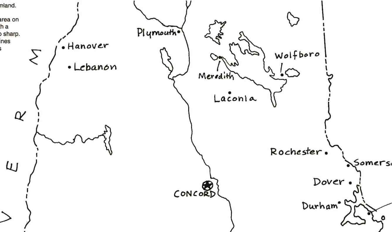
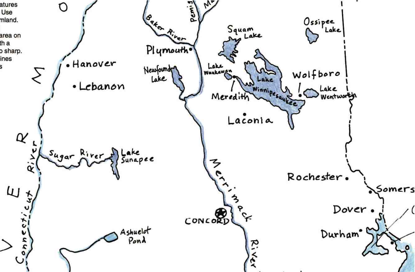
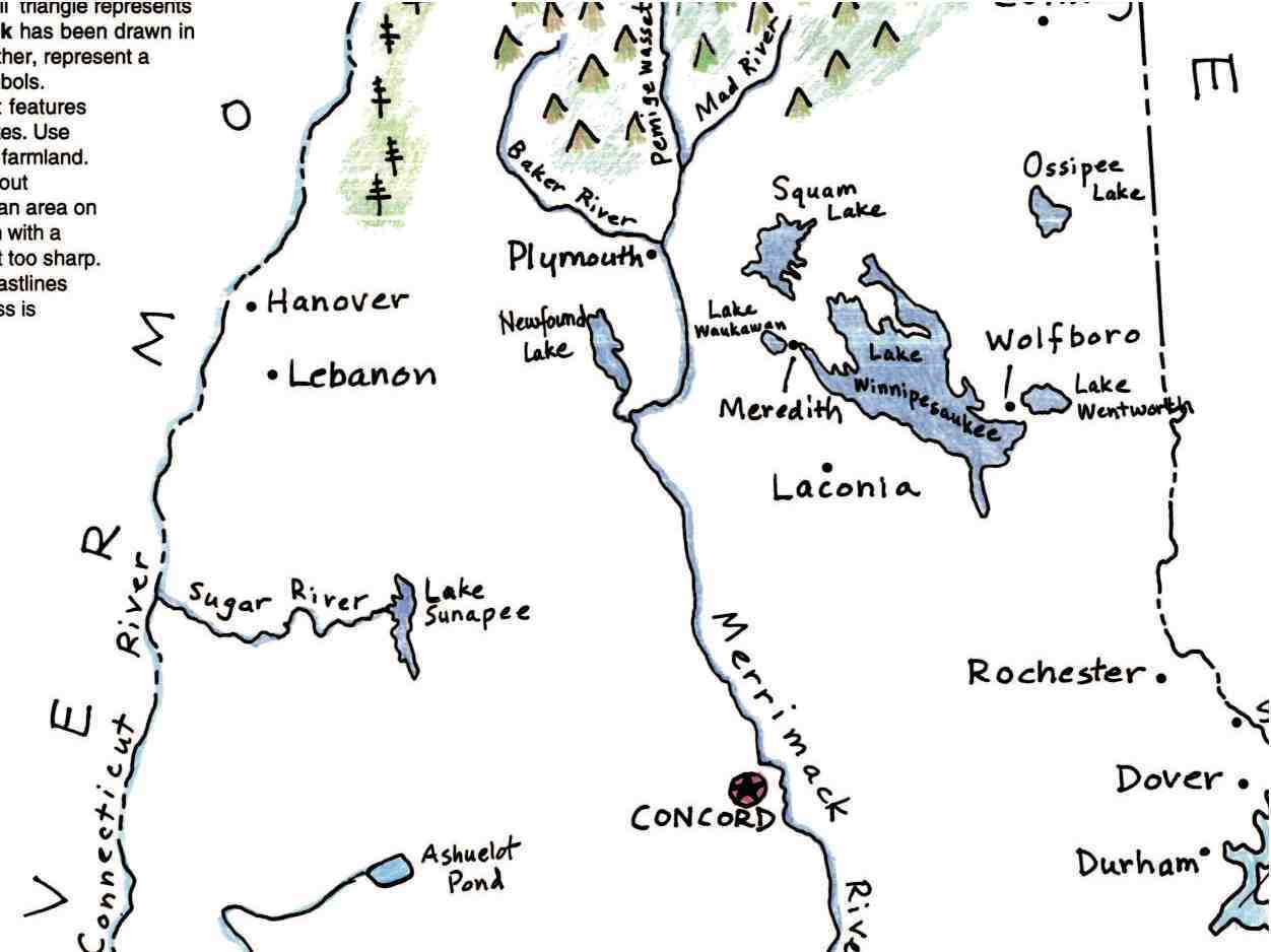
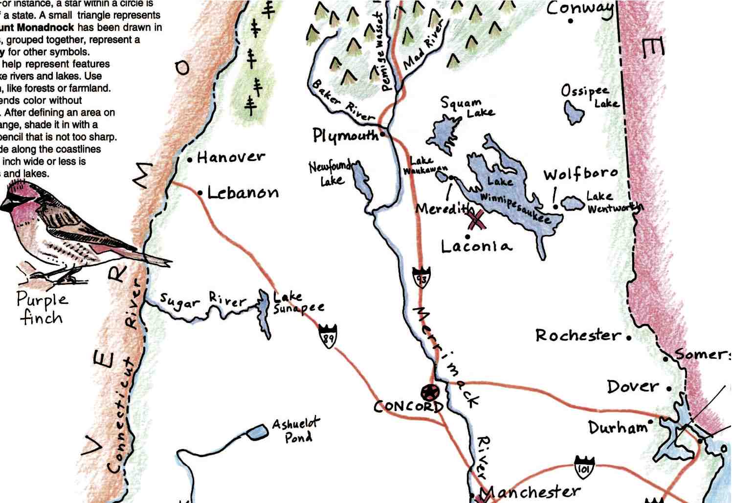
Since each map is different, the stages may vary slightly. But generally speaking, most of these features below are addressed. Here we show a small segment of our state map of NEW HAMPSHIRE, with each stage filled in as an example.
01
Labeling Places
The first thing to do in the early stage is to label the names of places: countries or cities, continents or regions. Here on the New Hampshire map, cities and the state of VERMONT is labeled to the left too.
02
Bodies of Water
Often in the next stage, bodies of water, such as oceans, lakes, and rivers, are labeled, then colored. Here you can see rivers labeled.
03
Geographic Details
You can next draw in mountain ranges, deserts, valleys and other geographic details, using the symbols shown in the Map Key. Fill them in with the appropriate color. Here you can see some forested land in New Hampshire drawn in, as well as mountains.
04
Additional Features
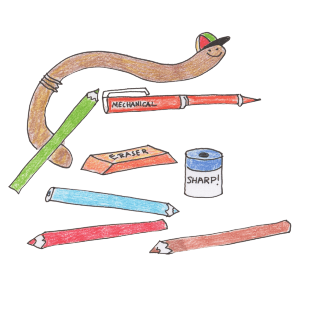
To add more detail, color other features, such as borders, illustrations and the compass rose. On some of our maps you can color our Earthworm mascot. Sometimes, especially on state or city maps, transportation details, such highways, railroad routes, or airports can be drawn in. Some maps are more complicated and have an extra stages, relating to history or regions. Or you can draw in extra details of your own, or make new illustrations– like the NH state bird shown here!– to further decorate and embellish your map.
Other Geography Resources
It is very helpful to have a range of resources– maps, atlases and globes– when working on our activity maps. Today students can use the internet to research, but it is wonderful to have other hands-on resources too when filling in details and labeling a map. Also, looking at different kinds of atlases allows students to see the way maps have looked in the past, and the many different styles that are employed to make maps today.
At Maps for the Classroom we have a library of geography books and atlases we have collected over the years. We encourage you to do the same! We have atlases that are up-to-date and show the world as it is today, as well as historical atlases that show countries of the world in previous times. We have books about ancient civilizations, American history, unusual animals from around the world as well as books about the earth and its surface, just to name a few! Some of our books are new and some are very old.
The best books have maps as well as text to explain how the geography of a region influences people who live there.
In addition to using your school and local libraries, you can build a library of geography-related books just for you own classroom, for reference and to learn more about the world, past and present. Be sure your maps are up-to-date and reflect the current state of the world.
You can buy new books — so many wonderful titles are available today. But if you have a limited budget for books, look for used or second-hand copies of books. Be sure to check your local or school library holdings. This gives you a chance to consider books you might like to buy inexpensively, through a local second-hand bookstore or a used book sellers online.
