June 27
Classroom maps: Students as Cartographers
0 comments
Hands-on geography activity maps kids & teachers
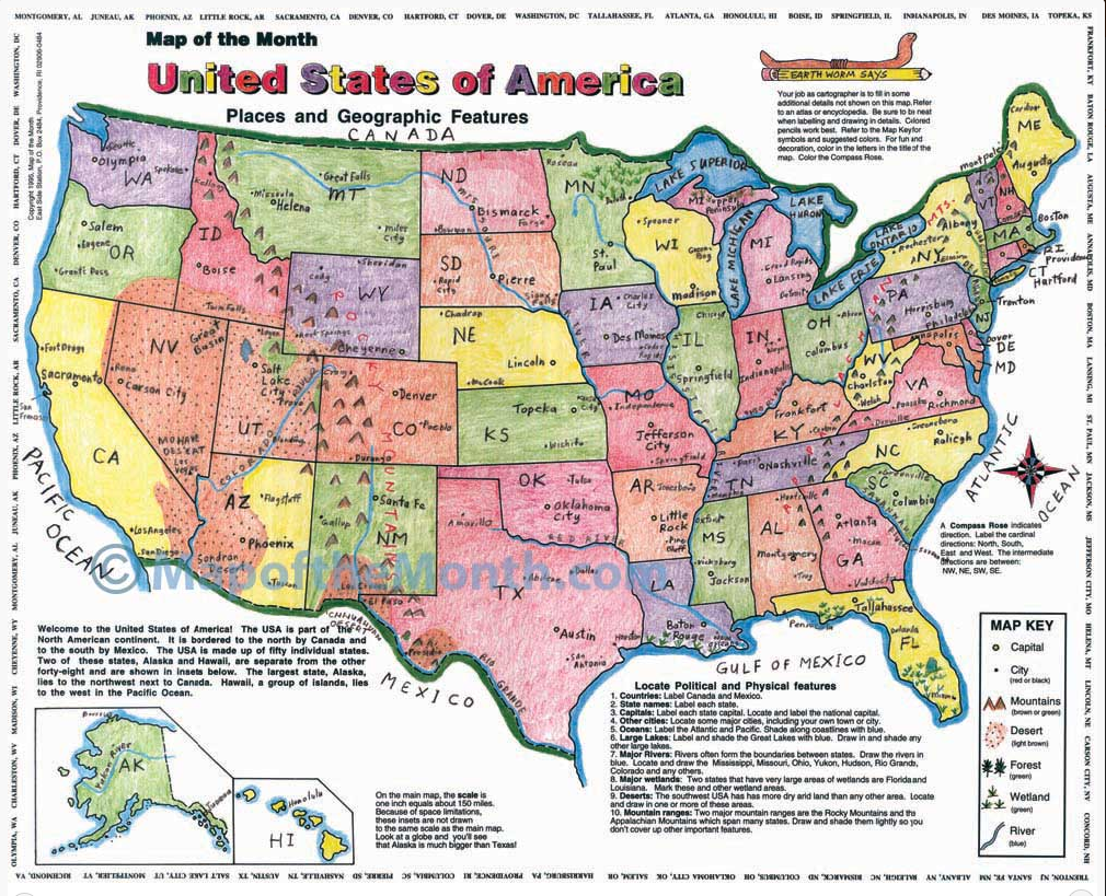
To see what our maps are about, we are presenting a small section of our most popular map: USA, PLACES AND GEOGRAPHIC FEATURES.
Our approach to teaching geography is simple and effective: students learn by a hands-on approach, by drawing in details and labeling large desktop size maps.
Kids learn geography by being cartographers themselves by using our detailed classroom maps!
Maps for the Classroom offers over 80 Hands-on Activity Maps, LARGE, desk-top size: 16″ X 20″. Easy for small hands to label. Students remember by creating a beautiful map that they are proud of! We encourage teachers to try our hands-on approach! We make teaching geography fun!

These examples are taken from this USA map, but all our classroom maps– our many World, Continents, States, Specialty and History— are done in the same way!
This detail shows a small area of the USA, PLACES AND GEOGRAPHIC FEATURES. Note that some text on the classroom map encourages the students: they will follow activities printed on another corner of the map.

A mapmaker’s goal to make the map clear and easy to read.
There are many ways of labeling a smaller area on a map where there is not much room to write. The area showing the states of the northeast is small compared to the states in the western part of the USA. It is easy to label the full name of a larger state because there is lots of room to write. With the small states, this is challenging!
Students can use the state abbreviation. This takes up less room than writing the full name. It allows more room to draw in other details, like cities and other geographic features. That is why it is easier to label a map first before drawing in other details!
Label the name of each state next to it and use a leader line to connect the name to the state.

When coloring a coastline, students have fun shading along the coastline with a blue pencil.
On this detail of the map, the GREAT LAKES are shaded and labeled with lower case letters. The map is starting to take shape!

On the large classroom map, it is a fun activity to draw in the mountain ranges that are part of the USA. In this detail of the map, we see a section of the Appalachian Mountains. They are colored with green and brown colored pencils, and their background is shaded in a mix of the two colors! The labeling of the mountains stands out when it is highlighted with a bright color, like the yellow shown here.
Students can draw in mountain ranges, deserts, valleys and other geographic details, using the symbols shown in the Map Key. Fill them in with the appropriate color.

At this stage you can choose to color the map by states, or by topographical regions. Here are two examples of different approaches to completing the map!
The first shows the USA in a way that shows topographical regions. The second shows the individual states colored in.

The kids in your class will enjoy learning about the world– and remember the details! — as they work as they work as student cartographers!
Check out the wide variety of classroom maps we offer as well as many countries of the world. Each of these large-format Hands-on Activity Maps –16” by 20”!

Tags
Session expired
Please log in again. The login page will open in a new tab. After logging in you can close it and return to this page.