March 30
Animal life in the Galapagos Islands
0 comments
Hands-on geography activity maps kids & teachers
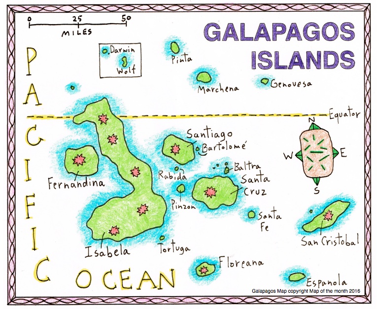
The Galapagos Islands are above and below the Equator in the Pacific. They are part of both Northern and Southern Hemispheres. These islands are part of the country of Ecuador and are 600 miles from the coast. They are considered to be in the continent of SOUTH AMERICA. The GALAPAGOS are an archipelago of volcanic peaks. Some islands are large, like Isabela, some small as rocks. Because these volcanoes are still erupting, small islands are still being formed!
Much of their flora and fauna of the Galapagos are unique, found nowhere else on earth. The scientist Charles Darwin traveled there in his boat The Beagle in 1835. He studied many species and developed his famous theories of evolution. There are marine iguanas, sea turtles, many kinds of amazing tropical birds, sea lions, whales and dolphins, to name a few!
Many native animals were lost when the Europeans introduced other more aggressive animals. Whalers drove a species of large tortoise extinct when they captured them for food and their precious oil. Fur-seals were driven almost to extinction by traders.
Today the Galapagos is protected: scientists are working to restore the numbers of small colonies of creatures, and to maintain the ones that are still active and numerous!
Students love to learn about unusual animals, so researching about creatures, and even plants, from the Galapagos is a great starting place. For a great list of Galapagos animals, insects, fish and more, use this link to Wikipedia HERE.
Here are some of the wonderful creatures of the Galapagos!
Scalloped Hammerhead shark

Green Sea Turtle

Waved Albatross

Having your students draw animals as well is fun! Here is the Galapagos Giant Tortoise!

You and your students can get involved with animals from many other ISLANDS by using our CartoCraze! Expanded Map Workshops! There are more than 40 workshop units. They all focus on different aspects of our amazing planet Earth. Geared for grades 3-8, these digital workshops integrate with our hands-on paper maps. They are conveniently organized into the following four geographic areas: ISLANDS, RIVERS, MOUNTAINS and DESERTS! SEE FREE files for the ISLAND of CUBA, the Mississippi RIVER, and the Sahara DESERT HERE.

If you love our maps, you will want the added advantage of going deeper into unique geographic areas. By exploring our maps in-depth, using the various units for islands, deserts, mountain and rivers, your students will use their map skills. And they will get a chance to read and research, explore scientific concepts, and exercise their math skills. They will also gain a better sense of the world at large, while using cross-curricular skills. Check out the complete list of over 40 files HERE!
Tags
Session expired
Please log in again. The login page will open in a new tab. After logging in you can close it and return to this page.