May 10
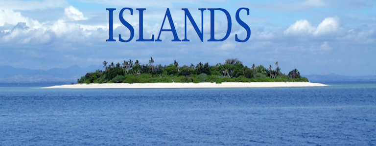
What is an ISLAND?
0 comments
Hands-on geography activity maps kids & teachers
ISLAND TERMS AND THEIR DEFINITIONS!
Here are a few terms that help explain what an ISLAND is. Can you and your students come up with other terms that relate to ISLANDS?
DESERT ISLAND An island not inhabited by humans.
ATOLL A coral reef shaped like a circle or ring and is filled with water. This is usually the tip of an extinct volcano.
COASTLINE The land along the outer edge of an island, where the land meets the water.
ARCHIPELAGO A chain or group of islands
BARRIER ISLAND An island formed of dunes, made of flat or lumpy areas of sand parallel to a coastline.
PENINSULA A piece of land that is surrounded by water on three sides but connected to mainland.
GULF A large bay that is connected to the ocean or larger body of water.
BAY A large indentation on a coastline that is connected to an ocean or lake
LAGOON A shallow body of water separated from a larger body of water by coral reefs or barrier islands.
BEACH Land along the coast of an ocean, sea, lake, or river consisting of loose particles made of sand or rock.
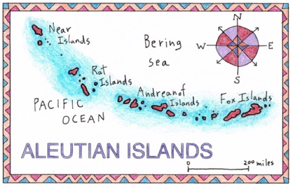
ALEUTIAN ISLANDS
The Aleutians are a long chain of volcanic islands, stretching for 1,200 miles.
The Aleutians divide the northern Pacific Ocean and the Bering Sea. There are 14 larger islands and 57 small ones. There are also 57 volcanoes! They are part of the state of Alaska, and the western islands in the chain stretch towards the Russian Kamchatka Peninsula.
Scientists have a theory that the Aleutians were once formed a land bridge, and were not divided by water. This might have allowed ancient people from ASIA to walk across to the continent of NORTH AMERICA.
There are only about 8,200 people in all the islands. They are called the Aleuts. In the Aleutians, a small city called Unalaska holds more than half that number of people in all the islands combined!
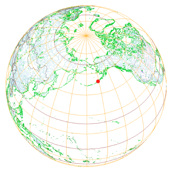
The RED DOT makes it clear exactly where the Aleutian Islands are located. Students could research on a more detailed map (maybe in an atlas?) to find the longitude and latitude lines that form the area where most of the Aleutian Islands are located.
Help your students learn more about ISLANDS and their unique characteristics!
Our CartoCraze! Expanded Map Workshops are digital files that can be shared by everyone in your school.
These files include special presentations about ISLANDS– as well as MOUNTAINS, DESERTS and RIVERS.
If you love our maps, you will want the added advantage of going deeper and in detail into unique geographic areas. By exploring our maps in-depth, using the various units for islands, deserts, mountain and rivers, your students will use their map skills as well as get a chance to read and research, explore scientific concepts, and exercise their math skills. They will also gain a better sense of the world at large, while using their cross-curricular skills. Below is a complete listing of teaching units for each geographic area covered.

Tags
Session expired
Please log in again. The login page will open in a new tab. After logging in you can close it and return to this page.