February 2
Himalayas and Mt. Everest: Greatest Peaks
0 comments
Hands-on geography activity maps kids & teachers
The great mountain range of giant peaks called the Himalayas crosses many countries in the continent of Asia. The range spans the countries of India, Nepal, Bhutan, China and Pakistan.
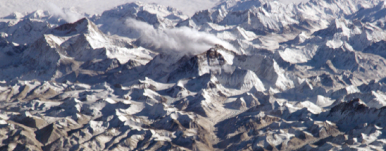
Mount Everest is the tallest mountain in the world and part of the Himalayan Mountain Range. Everest is 29,029 feet high, or 8,848 meters. The boundary that divides the country of China from the country of Nepal runs through the center of Mount Everest.
The climate of the Himalayas can be very different from area to area. In the south, there are tropical areas. In the highest magnificent peaks, the snow and ice never melt. Over the centuries, Indian people have traveled from the torrid summer temperatures of the cities to vacation in the cooler areas of the Himalayan foothills.
This is an image of the Himalayas taken by NASA’s Landsat 7 Satellite. It shows the curved shape of this huge mountain range that stretches for 1,500 miles from east to west.

In the widest western section, the width of the range is about 250 miles and in the east, the width is a little over 90 miles. To the north is the huge Tibetan Plateau. Note that the high peaks, seen here in white, are covered with snow!
People throughout human history have been fascinated with mountains. Their majesty and size fills us with wonder– inspire your students with details of a world they are yet to know! Mountains have inspired religion and mythology, and are the setting for stories, tall tales and literature. Men and women have set out on adventures and accomplish epic feats in mountainous terrain. Your students can learn more information about mapping, geography, people and animals of this fantastic HIMALAYAN region!
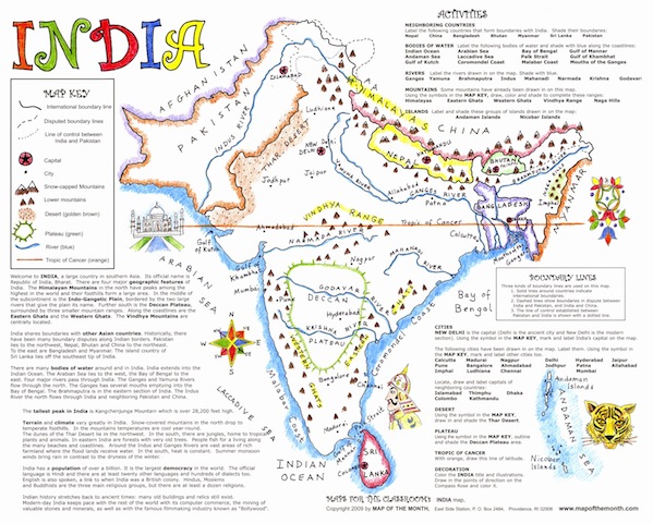
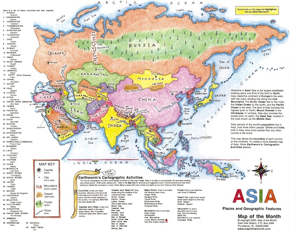
When you use our CartoCraze! Expanded Map Workshops on your smartboard, along with our hands-on activity maps, you will see how many extras there are to enhance your student’s work. The HIMALAYAS and the MOUNT EVEREST files work well when using our INDIA map and our very popular ASIA map. Students will learn more about the geography of the Himalayas, and also other fun topics, like learning about prayer flags in Buddhist temples and endangered animals, as well as some history about who was first to climb the highest peak in the world.


Other mountain ranges are covered in a similar way in our CartoCraze! Expanded Map Workshops.
Along with Mount Everest and the Himalayas, these are the other mountains and ranges your students can study when working on our hands-on activity maps:
The Alps: goes well with our EUROPE map.
The Appalachians: fine for studying our USA maps, TRAILS WEST and The Thirteen Colonies maps.
Denali: great for working with CANADA and Alaska maps.
Rocky Mountains: use with our USA maps, individual STATE maps, as well as our TRAILS WEST maps.
Andes Mountains: expands the use of our SOUTH AMERICA and Maya/Aztec/Inca maps.
The Great Dividing Range: perfect for working with AUSTRALIA map.
Urals: fine with EUROPE or ASIA, since these mountains rise between these continents!
Tags
Session expired
Please log in again. The login page will open in a new tab. After logging in you can close it and return to this page.